Friday, July 15, 2005

July 15th – Sequoia National Park to Bakersfield, CA

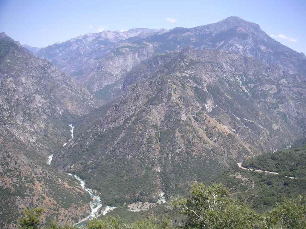
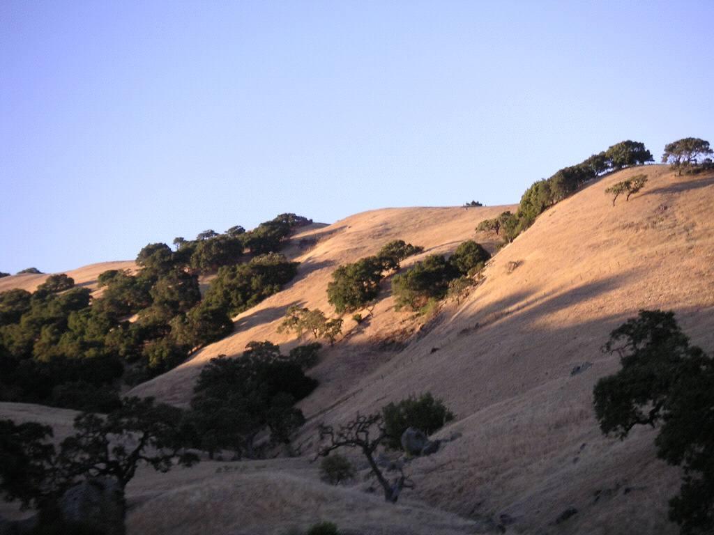
Got up early this morning after yet another uncomfortable night to find the air quite chilly. I guess it does get cool up at this altitude even this far south! We went south to Sequoia National Park and found the first helpful ranger so far this trip! Other rangers before and since have seemed actively to avoid (a) noticing someone has come within their vicinity and may want to ask something and (b) giving more than the bare bones answer to any questions asked. Very refreshing, then, to walk into the Giant Trees Museum and be greeted by a ranger who then offered all sorts of useful trail information! On her advice, we opted to avoid a more popular trail, and instead went for the Crescent and Log Meadows trail.

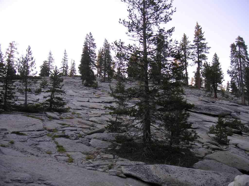
On the drive (down a spur road from the main highway through the park) we stopped at the marked highlights. There was the Auto Log, which had been used as something of a driveway for years until it started to decay beyond safe limits. People can still walk on it though, and that we did! We also made a stop at Tunnel Log, which as a tunnel burnt into it, and one can drive a car through it (we did). Moro Rock turned out to be much larger than I had anticipated, and involved walking up about 300ft (mostly on carved stone steps) to get a beautiful, nearly 360-degree vista at the top! Definitely worth the walk up, despite the scary warning signs about death-by-lightning. We also spotted cute Western Fence Lizards, one of which had evidently lost its tail in the past and had regrown another. The meadow walk was really nice too, with more giant sequoias to see and lots of wildflowers and birds and squirrels and chipmunks to see. About 500meters from the busy picnic area/trailhead was a cinnamon bear ripping bark off decaying logs (looking for lunch). Everybody seemed to think this was great, with not a glimmer of concern. While I was very glad to have a chance to see the bear during the walk, I’m used to people showing a little more concern. Especially when we heard that two sows with cubs were resident along the trail. Unfortunately, along with all the wonderful sights, there were also an abundance of mosquitoes and we had forgotten the DEET. Oops!

We drove down the winding road out of the park – at times the posted speed limit was 10MPH because of the sharp turns. Saw more large trees of all kinds, and more yucca plants. We’d seen these arid-climate plants all through this area and were amazed at their flower/fruit stalks. These stalks can stand nearly 10 ft tall, and the plants seem to produce only one before dying off. We’ll need to learn more about yuccas.

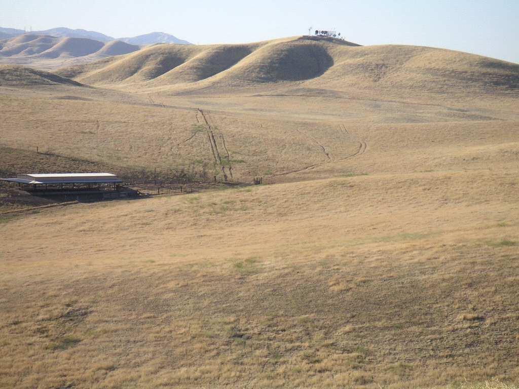
It’s another scorching day down at sensible elevations; we just checked the weather channel and found it had been 105F and 30% humidity today. No wonder the drive to Bakersfield was groggy and unpleasant! We even had to stop for road construction – I would have thought that construction season would be anything but summer, given the soaring temperatures here! A lot of smog seems to collect in this valley too (which includes Sacramento and Fresno). We’d originally planned to drive a few hours further, but just wanted to get out of the heat. So here we are at an air-conditioned motel, well fed from the diner/burger place next door, and updating our blog!

Tomorrow will be another scorcher, and we’re going through the Mojave Desert. Note to self and everyone reading this: next time, do this part of the continent during early spring or late fall!

July 14th Pictures -- Kings Canyon National Park


These two sequoias have grown together as they matured, and are known as the "Twin Sisters." They are located in Grant's Grove (Kings Canyon National Park) along with all sorts of other neat stuff. If you squint you might be able to make out Kris acting as scale at the base of the trees.


This view of Kings Canyon was taken as we descended into the canyon - the jagged rocky walls were peppered with shrubs tough enough to hold on, and lots of agave plants.


A beautiful walk near the end of the road meanders through rock fields and meadows under the face of North Dome - a really big cliff.

July 14th – Kings Canyon

Today we drove along the Generals Highway into both parts of Kings Canyon National Park. We made a stop at Grants Grove Village (just inside the eastern gate) to pick up supplies and do the short, paved loop displaying a stand of ‘famous’ trees – these trees were named for Civil War Leaders and states during the latter half of the 19th Century. These sequoias were certainly impressive in size! One fallen log, named the Monarch, had been used for a temporary shelter by Native Americans and early pioneers, and as a saloon and inn and to stable US Cavalry horses 100 years ago!

It was another hot day, and a picnic by Grizzly Falls was a welcomed respite. Unfortunately, the natural beauty was marred by a giant American flag planted over top of the falls – we weren’t aware that these falls were part of a territorial dispute.

We did a short meadow walk in the western part of the park, spotting pretty flowers and fun squirrels. Pretty mottled California ground squirrels have a light V-shaped patch at the back of their neck and shoulders, and the one western grey squirrel we saw was sitting in the middle of the trail munching on an acorn. Other hikers also pointed out a garter snake hiding in amongst dry leaves! (We did see another patch of dry leaves and twigs moving, but it turned out to be a rather long and creepy worm!) We also saw this huge wasp leaving and then returning to its hole-in-the-ground home, which also seemed creepy. The parks are full of large black bees with just a patch of yellow in their heads and sometimes at their bases too. They would have been cute had one not decided that my skirt was a flower!

Kings Canyon has the same geological history as Yosemite valley, with granite valleys sculpted by the passage of glaciers and rivers. The resultant valleys have huge smooth rock walls in parts, as well as rough talus slopes. Our meadow walk wound around under the face of a huge cliff rising hundreds and hundreds of feet over our heads. At our final stop in the eastern section of the park we startled a mule deer doe with two fawns as we pulled up in the car. The fawns were so tiny and spotted that they looked like someone’s pet dogs. But boy could they bounce/run when startled!

To avoid the mosquito onslaught, we had supper in a picnic site far away from our campsite. It certainly helped, although we made a stop to look at roadside flowers on our way back to the tent and were attacked by these pesky bloodsuckers! We’re now wishing for a pet bat to take with us camping.

July 13th pictures - Arrival in Sequoia


Driving towards our campsite we passed a lookoff over a huge grove of sequoias -- this pictures shows their droopy looking tops sticking up from a ridge of forest.


Our campsite was located a few miles down a winding little road off the Generals' Highway, at the base of a huge slab of brittle granite.


The small brook running through the campground provided a home for fish and lots of lush greenery, such as this shooting star.

July 13th – Monterey to Kings Canyon National Park

Because we stayed up late the night before to update the blog, we had a late start this morning out of Monterey. We had a fairly uneventful drive to Fresno; the only thing of note was that the air temperature kept increasing until it was over 100F. We managed to get confused by the triangle of highways intersecting around the city of Fresno, and had to drive in the hottest part of the day in this smoggy, muggy valley for way longer than necessary. On the upside, we got to see some Sunkist orange groves, which were very pretty!

Kings Canyon National Park actually has two sections: the east and west parts are separated by National Forest, and abuts Sequoia National Park. We had a brief stop at a picnic area just inside the east gate (known as “Big Stump Entrance”) of Kings Canyon, and headed through to Giant Sequoia National Monument where we were able to camp for free. Even though the elevation was over 7000ft (which in Jasper would be frigid and above the treeline), it was still quite warm in the early evening. It also seemed to be a breeding ground for mosquitoes. Ick!

The exposed granite landscape here is fantastic! Toby mentioned it felt like camping on the moon! I had actually experienced the hills of granite just outside of Atlanta, Georgia several years ago. Anyway, it was really neat to climb the hill across the road from our campsite and get a close-up view of sequoia trees.

Sequoias are the largest tree by volume, and these two National Parks and the surrounding National Forests were incorporated to preserve stands of large sequoias. They have lovely red bark which seem to grow in vertical stripes. The needles are similar to cedar, and the cones are only about egg-sized. These trees have very thick bark and their their living parts in the outer few inches of wood; the inner core is composed of by-products, one of which is tannins. These tannins prevent decay by insects and fungi, so sequoia logs seem to last forever. Indeed, park staff have compared photos of some famous fallen logs in the park from over 100 years ago and could not observe any change due to decay! The cores also seem to burn easily, and many giant sequoias bear the scars from forest fires, and many logs are actually completely hollow!

Wednesday, July 13, 2005

Sea Lions


As with many sea mammals, sea lions seem so silly on land! Many were spotted sunning themselves on rocks, occassionally moving a flipper to scratch, or roll over to warm the other side. They reminded us of our cat, Sam, lying on his back and waiting for a belly rub!

Sea otter in the Monterey Bay Aquarium


We elbowed our way towards the sea otter exhibit for the last feeding session of the day, and watched as Mae and Maggie munched and played happily. The 'aquarists' threw tasty morsels to the otters, interspersed with activities such as moving towards a target, going into a carrier, and retrieving toys. After, food was put into large plastic balls with holes, and the otters had to play with these balls in order to extract the tasty pieces. Later in the day, we watched as one of these otters grabbed some sea grass from the bottom of their tank and carried it through the tunnels of the exhibit.

Tuesday, July 12, 2005

July 12 - Monterey, CA

We started off with a hearty breakfast at the funky Old Monterey Cafe - Toby had huevos rancheros, while Kris had a salad variety plate. Since it was wonderfully cool and sunny, we wandered along the shore and along Cannery Row to the Monterey Bay Aquarium. Our hotel sold us advance tickets for the aquarium, so we got to bypass the lineups at admission. Though the place was rather crowded with tourists like us and with kids summer camps, we did manage to see just about everything.

Lots of interesting fishes and shellfish to see. There was a coastal land area, complete with rescued shorebirds like avocets and plovers. (One silly plover-like bird was running back and forth along the edge of the caged-in area; perhaps it was suffering from cabin fever?) The highlights were the sea otters (of course) and jellyfish (surprisingly). The aquarium has an entire section devoted to jelly-fish inspired artwork interspersed with jellyfish tanks. It turns out that jellyfish release polyps which then develop and end up releasing many baby jellyfish - an odd way to reproduce. Speaking of which, about 1/3 of sharks, rays and skates produce young within egg sacs (also known as mermaids' purses). The embryo takes about a year to develop before it leaves the protection of the sac.

One of the advantages of living in this temperate climate is the use of outdoor space, and the Monterey Bay Aquarium definitely does this well. We spent much of the time outdoors, observing the wildlife in the nearby waters. We were able to spot wild sea otters this way! (Kris' life is complete - she has seen sea otters in the wild!) There were also juvenile cormorants, young guillemots and seals galore to watch.

After leaving the aquarium, we wandered back along the seashore, stopping in at some of the silly touristy shops. Got some fried calamari along the Fisherman's Wharf, and spotted some more wild otters in the marina! One of these otters was caring for a pup. Although they were far enough to make viewing difficult, they were still incredibly cute.

We went through the weekly market in Monterey on our way back to the hotel this evening. It was wonderful to see so much fresh produce available, and made us miss having ready access to a kitchen. We did pick up some fruit for the next few days, and some snack foods for the evening.

Next up, we will head back inland, and spend a few nights at King's Canyon and Sequoia National Parks, then move towards the Mojave Desert. Hopefully Kris won't melt - the forecast has been for record-breaking heat!

Scenes from the Freeway


South of Sacramento, Interstate 5 goes through a rather remote part of California, with dry-looking hills. The California aquaduct runs through the San Joachim Valley here, and we followed it for a few hundred miles, finally leaving it at the San Luis Reservoir.


As we approached the coast, vegetation increased. These trees were so pretty, the Platonic ideal of "tree", in the setting sun.

July 11 - Crater Lake, OR to Monterey, CA

Today was a driving day. We left Crater Lake at about 830am, and arrived in Monterey about twelve hours (and a few major road construction projects) later. It was very warm driving south along I5, with temperatures of about 100F. The landscapes were beautiful in their scrubbiness, and somewhat surreal in the way they were transformed by irrigation.

It was incredibly refreshing to reach Monterey with its ocean moderated climate - for the first time since leaving Crater Lake we stopped sweating.

Wizard Island (in Crater Lake, OR)


Wizard Island is a smaller volcanic cone, located in the collapsed crater of Mt. Mazama. Long after the Mt. Mazama eruption this smaller cone developed, along with another which is now submerged below the water of Crater Lake. When boat tours are running, one may disembark on the island and hike to the top.

The Water is so blue...


The water in Crater Lake is incredibly clear, and has a magnificent blue tint to it. At first we thought that it was just a trick of viewing it from hundreds of meters above, but it turns out that the colour remains vibrant even a few feet away.

Kris at the side of Crater Lake, OR

The Pinacles, Crater Lake National Park, OR


These fumeroles seem to sprout from the side of the creek beds in the southeastern portion of the park - they are welded together from volcanic debris thrown out by Mt. Mazama at one point or another.

July 10 - Crater Lake National Park, OR

Had a rude awakening overnight. The power went out in the 'village' and when it came back, the smoke detector beeped loudly to let us know. This happened several times before power was finally restored. Luckily the day dawned clear and sunny, making the stay worthwhile. We stopped briefly at the visitor's centre, only to find it rather kitschy. The one ranger we spoke to didn't seem too interested in hearing about our comparisons between their wildlife and that of Jasper and Banff.

However, we did the splinter drives off of the Rim Drive. The Pinnacles turned out to be way more amazing than I expected. Probably because I thought this drive would just take us to a vista of mountain peaks. Instead, the Pinnacles are tall fumeroles - hollow spikes of hard rock where softer stuff has eroded away. Some were rather hoodoo-like (for those of you who have been to the badlands either in Alberta or in the Dakotas), others looked phallic, while still others were like minarets. Striking!

We also did a few of the hikes. The first was down to the lakeside along the Cleetwood Trail. Many dire warnings about the difficulty of this 1-mile climb were discouraging; fortunately we've been accustomed to Rockies day-hikes, so this one wasn't as bad as the signs had me believe. This trail is the only route down to the lake and is usually taken by those who want to take the boat tour around the lake. Unfortunately the boat tours had been cancelled indefinitely (foul weather), but we went down anyways. The water retained its eerie blueness even when one was peering down over the edge from the lake's shore!

There was also a wildflower trail which took us through a lovely meadow and across some streams. While we did see some wildflowers (others had already bloomed), the highlight was spotting two deer and two fawns on the cliffside! As luck would have it, this was the one time we hadn't brought our binoculars with us. Oops!

Mazama Village Motel


Here's our lodge at Crater Lake. It was originally built to be a temporary hotel when the Crater Lake Lodge (much swankier) was being renovated, but now it's rented out to cheaper folk like us. (= If we'd realized how exaggerated the crowds were in the park, we'd certainly have camped instead. Especially after we realized that the campsites were at a lower elevation than the lake itself, making for a warmer stay.

Crater Lake


A beautiful blue lake, 6th (?) deepest lake in the world. The cone of the crater is actually flattened and below the surface of the water. The surrounding cliffs, the caldera of the crater, gives geological information about the volcano, Mt. Mazama, before it erupted. Smaller eruptions afterwards created cones on the landscape nearby.

Pumice Desert


This desert was left when the nearby volcano erupted. It's composed of walnut-sized rocks, ranging in colour from beige to pink to rust to charcoal.

July 9 - Bandon to Crater Lake National Park, OR

After more frustrating calls to the Mazama Lodge at Crater Lake, we finally managed to make reservations. This turned out to be a disappointing accommodation with poor facilities and poorer staff. (They actively avoided acknowledging people trying to check in or check out! I guess when you have a monopoly on places to stay...)

We drove inland from Bandon, and entered Crater Lake National Park via its north entrance. The lake is indeed a large crater, created about 7700 years ago when the volcano Mt. Mazama erupted. Over time, the crater filled with water from spring melt and rain, and has now reached an equilibrium.

The north entrance to the park takes one first through the Pumice Desert. This desolate field has small scrubby plants, but from a distance looks like a dry plain. We were surprised how colourful pumice rock is - all shades of pink and brown. I'd assumed that volcanic rock was all black.

Rim Drive is a 33-mile road circling the entire lake, and our motel was in the south end of the drive. So we took the recommeded clock-wise route, pulling over at the very first viewpoint. The parking lot is downslope from the lakeview, so anticipation was certainly building! We were not disappointed in the least. Even though it was overcast, and drizzling on and off, the lake's legendary blue-ness lived up to reputation! As we meandered around the lake, getting views from the steep caldera, we gained an appreciation for the varied textures along the rim. I'm not sure how many people spend as much time as we do at these kinds of things, but I suspect most visitors don't bother to stop at EVERY pull-off to take photos of the lake and admire the new angle!

Wildlife here is similar to that of the Canadian Rockies (with which we are more familiar), only smaller and less aggressive! The Clark's nutcracker (aka the Camp Robber) hopped around a nearby tree, unlike the Rockies Robbers, which would steal food from your hand if you turned your head! The golden-mantled ground squirrels were also much smaller than the Rockies variety, but equally cute to observe! Over the 1.5 days we were in the park, we also saw several yellow-bellied marmots, black-tailed (?) deer (with two fawns!) and elk.

Oregon Coast Photos


Kris braves the wind and rain to pose for a photo on the dunes.


One of the stops we made along the Oregon Coast was at Cape Foulweather, and true to its name, the weather discouraged a lengthy stay!


The next morning (when we're leaving the coast) the weather clears up in Bandon, OR. Here's a photo of our lovely guest house.

July 8 - Portland to Bandon, OR

The weather this morning was cool and cloudy as we left Portland and caught late-morning traffic slowness out of the city. We took a route SW and out to the coast. The Oregon coast is beautiful, and this highway has many road-side stops at which to admire the views. Unfortunately, it rained all day, so we only had glimpses of the near-shore. The Oregon sand dunes were really neat - I hadn't expected so much vegetation! We even managed to avoid any collisions with dune buggies.

Having had difficulty finding accommodations at Crater Lake National Park for that evening, we opted to stay at the Seaside Hostel and Guest House in Bandon, OR. This place is in Old Bandon, right across the street from the water's edge. It's a lovely place to stay with a wonderfully down-to-earth hostess. Definitely not one of those impersonal hotel chains! We even had a chance to do a load of laundry here.

We wandered around the old town and had a really nice dinner at the Wheelhouse Restaurant (seafood, of course). Actually, we were technically in the bar upstairs, called The Crowsnest. This turned out to be a furtuitous event, as we got to sit at the window overlooking the bay and watch as the skies finally started lightening up around sunset. Also had some seemingly close-calls with gulls and starlings flying to the eaves just above our seats' window!

Toby and Suzanne (and little one to come)


We had a chance to have lunch with Suzanne, one of Toby's college friends, at a lovely diner-ish cafe in N Portland. (By the way, Portland is divided into 5 areas: SW, SE, NE, NW, and N.)

Toby and Tom Reunion Tour


Since Toby met Tom through the UofA juggling club, it seemed only fitting that they had an evening to juggle together, and what better time and place to do so than overlooking the city of Portland at dusk?

July 7 - Portland, OR

Today started off with a wander through the labrynthian Powell’s Books in downtown Portland (comes with a map to guide a visitor through 6 rooms over 3 floors), including parking in one of the most confusing parking garages I have ever been in. (We had to wait for the parking attendant to come to the car to give us instructions, then, once we parked, we had to give him the car keys.) Then lunch with Suzanne! She managed to schedule us in before an important delivery thankfully – her second child is due next week. We learned about the endangered Pacific Northwest tree octopus (from her “Think Before You Click” workshop for youth and the internet). It’s great to see old friends after so long!
Then the afternoon was spent wandering along Hawthorne, one of the trendy areas in town, eventually ending up in a smaller Powell’s bookstore outlet. We stopped in the attached coffee shop for a drink before heading ‘home’.

Walking around these neighbourhoods has been a wonder for our senses. Rosebushes, glads, pansies, nasturtiums, and tonnes of other that neither of us can identify. Beautiful gardens everywhere. And the ‘hens-and-chicks’ have all sprouted these tall protrusions – is it their centennial seeding time? Maybe one of you reading this can inform us about these odd plants.

We met up with Tom and headed up to Rocky Butte to admire the views, have a lovely hummus, pita, tomato and pear picnic. Afterwards, Tom and Toby got a chance to pass clubs (two consecutive nights of juggling for Toby). The cloud cover opened up enough for us to see the peak of Mt. Hood. (Or Mt. Wood, according to Toby.) Can only imagine how impressive it would be had the weather cooperated!

Monday, July 11, 2005

Early Vinyl Player at Tom's Place


Here's Doug's (Tom's landlord) early wax disk player. We were pretty impressed with this working relic of a bygone recording era!

Multnomah Falls, Oregon


These fabulous falls are located a scant few hundred meters from the interstate -- a treasure even the most harried traveller can squeeze into a rushed trip. You may recognize them from a postcard or two.

View of Columbia Gorge from Rowena Crest


The Columbia river, as seen from a the old highway up the Columbia gorge

July 6 -- Ellensburg, WA to Portland, OR

Today saw us wending our way south towards the Columbia gorge, through more scrub followed by arid pine forest. Although we didn’t stop at Stonehenge (Mark II), we did take some time to admire some of the amazing views over the gorge via the old Columbia River Highway (much prettier and slower than the interstate), and some of the beautiful waterfalls as we neared Portland – the Multnoma falls were astounding (but crowded).

We found Tom in this amazing house in Portland. It was built in 1924 and has been beautifully restored by its current owner, Doug. There’s all sorts of cool detailing in the lamps and windowsills, and has circular kitchen cupboards. The highlight for us was the working wax cylinder player which Doug had purchased as a teen and restored using lots of WD40! (Actually it plays wax disks instead of cylinders. And its “volume control” involves moving a mute in and out of the bell-shaped speaker, much in the same way a trumpet mute works. It is so amazingly lush here – we picked raspberries, strawberries, blackberries and plums on the way to supper! I loved the arid landscape we were in before, but this also has its (yummy) advantages! Doug’s grown grapes, kiwi (our first growing kiwi plant!), strawberries, raspberries, plums, and one perfect little cherry on his cherry tree.

The Toby and Tina Reunion Tour


After a short (8 year) hiatus the unstoppable duo reunited for another six-club passing routine. Somehow it seemed easier when we were in college...

Geocaching with Tina and Jerry

July 5 -- Ellensburg, WA

Today started with an overly large breakfast (at about 1pm) at a diner chain called Perkins, followed by an introduction to geocaching in the scrubby hills surrounding Ellensburg. Geocaching is an interesting hobby, although it must look awfully suspicious to be secreting camouflaged packages in more urban areas. Saw a bounding bobcat bounce across the road in front of the car (except Kris was dozing and missed it) and later found a tiny tick tickling my calf during a short walk to a cute cascade with colourful critters flitting about. We ended up 'logging' 2 real geocaches. One was a small ammo can filled with all sorts of goodies and a disposable camera with which to take photos; the other was a micro (a film canister). We also went to the small but pretty Umptanum Falls, a virtual geocache and a great getaway from the town. Finished the day with another BBQ - this time at Tina's mother's RV in the KOA campground near Ellensburg - and a chance to pass clubs with Tina for the first time this century.